No New Signs of GPS Interference in the Barents Sea

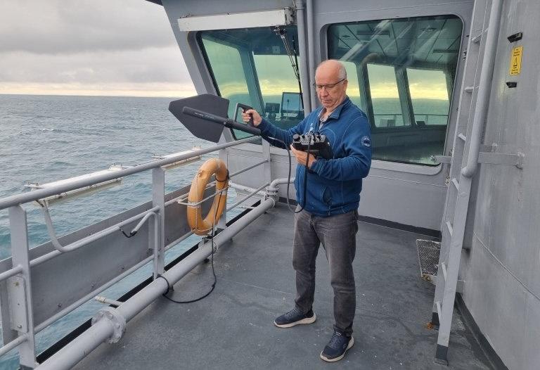
Last week, the Norwegian Communications Authority examined the area between Kirkenes and Båtsfjord, Northern Norway, to map for possible GPS interference in the Barents Sea. This was done in collaboration with the Norwegian Coast Guard vessel NoCGV Barentshav. (Photo: Nkom)
After several reports of GPS disruptions in the Barents Sea at the start of August, the Norwegian Communications Authority has conducted its own examination. No disruptions were discovered this round, but the situation will be closely monitored.
Regular GPS interferences have long been reported in the airspace above Eastern Finnmark in Northern Norway. This is particularly linked to jamming, but there are also instances of spoofing.
Emerging reports now show GPS interference in the Barents Sea as well: Earlier in August, the Norwegian Communications Authority (Nkom) received several reports from the Norwegian Coastal Administration, the Norwegian Coast Guard and Telenor Coastal Radio that navigation equipment in the sea area was affected by jamming.
This could impact safety at sea, and Nkom therefore conducted its own examination off the coast of Finnmark between Kirkenes and Båtsfjord last week.
No disruptions were detected in this round, but Nkom will closely monitor the situation going forward.
"We take reports of GPS interference very seriously and have established close cooperation with relevant authorities. At the same time, we are assessing the need for further measurements and analyses going forward, says Espen Slette, Department Director at Nkom.
GPS interference
Jamming is the interference or blocking of, among other things, radio and GPS signals, while spoofing is the transmission of false signals to deceive the receiver who receives these signals. (Source: Nkom)

Chief Engineer at Nkom, Åsgeir Henriksen, during the mission in the Barents Sea. Here, he has measuring equipment to document possible sources of the reported interferences. (Photo: Nkom)
"A map and compass should always come with"
"All who use navigation systems should be able to trust the information they receive from the equipment. Blocking GPS signals is unacceptable and illegal, and could have serious consequences for maritime traffic, preparedness, and other critical infrastructure," continues Slette.
He also emphasizes that it is important to have alternative solutions available.
"GPS is an important navigational aid, but it is not infallible. Therefore, everyone must be prepared for it to fail and have access to alternative navigational tools. Paper maps and a compass should always come with, and there should be regular training in navigation without the use of GPS."


