“Dynamic Hangover” Is a Go: The Hunt for USS Gerald R. Ford
(Video: Arne O. Holm)
Vestfjorden: The world's largest aircraft carrier was met with cheers in Oslo a week ago. However, ever since the American aircraft carrier USS Gerald R. Ford left the Norwegian capital, it has been silent. Dead silent.
Even the electronic traces that ships leave behind have been erased by the public. When the world's largest warship now sails into the High North, it is without fanfare and enthusiastic politicians in its wake.
Imaginative names
I have embarked on the hunt for USS Gerald R. Ford. With peaceful means. "Dynamic Hangover", a name inspired by the many imaginative names of military operations in the north, is a go.
Along the aircraft carrier's sailing route, flags and cries of encouragement have been replaced by the seriousness that characterizes a Europe at war.
No one will say where the USS Gerald R. Ford is heading, other than that the course is set north along a coast that ends in Russia. That is illustrative of a warship's operations.
Daily press reports have ended. No commercial TV teams are aboard the boat and the crew of 4500 soldiers and officers are back after a likely well-deserved leave in Oslo's many bars and cafès.
Because this is serious.
The electronic traces have been erased by the public.
No spectators
The significance of the Norwegian-American cooperation, which was emphasized while the ship was anchored in a peaceful fjord further south, just deep and wide enough for the world's largest aircraft carrier, will be demonstrated in practice in the coming days and weeks.
Without civil spectators.
Somewhere in the north, the ship will join the ranks of military aircraft, boats, and armed forces. The ranks of almost continuous military exercises from the Western and Russian sides.
Even a ship that is 337 meters long, 78 meters wide, and 76 meters high, becomes a needle in a haystack when it roams the High North open seas. A poor metaphor, seized from a farmer's field, I admit.
In advance, I had read how rubbernecked Oslo citizens created traffic chaos on the residential roads along the Oslo Fjord.

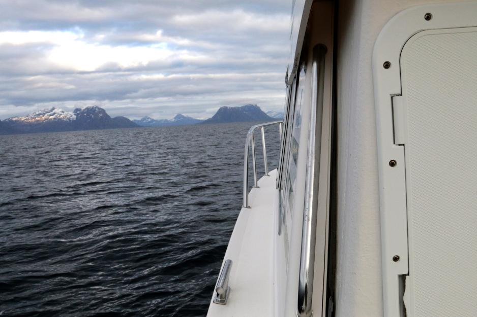
In the middle of Vestfjorden, just before the announcement of a major military exercise. (Photo: Arne O. Holm)
"The worst thing I have ever seen," commented an Oslo citizen to one of the capital's newspapers.
He was not referring to the war but to the driveway in front of his house, filled to the brim with cars and rubbernecks on the hunt for a glimpse of the ship.
Traffic chaos
Chaotic traffic could also be found along the only road to the north from Bodø, but that was not due to crowds on the hunt for military vessels. The European Route E6, which connects the north and south above the Arctic Circle, is a continuous chaos of tunnels so narrow that any meeting of trailers creates endless queues. Passing is done with millimeter precision. But only if the side mirrors are folded in. Along these roads, military equipment and whatever a population in the north could need is transported.
The state budget rarely covers Northern Norwegian infrastructure, whether it concerns roads or power lines.
The worst thing I have ever seen.
I have only minor clues to go by in my hunt for the American aircraft carrier. The ship was possible to trace in charts out of the Oslo Fjord and for a short while when heading toward Western Norway. AIS is the name of the system.
However, just like the Norwegian frigate KNM Helge Ingstad, which sank in the Hellefjord after a ship collision in 2018, Gerald R. Ford also turned off its signals as soon as it truly made sense to follow its voyage. Even our own Chief of Defense, Eirik Kristoffersen, implied that he did not know where the ship was heading.
Only the Americans know he said in a couple of interviews I caught before I set off on my own mystery voyage in the north.
Pointlessly imprecise
The local newspapers in the southern part of Norway reported that the ship was sailing within their coverage area for some time. TV2 "learned" that the course was set for Arctic waters. A geographical piece of information as pointless and imprecise as sun-starved Norwegians' vacation to a country called the South.
The Arabic TV station Al Jazeera also got hold of the same information. According to Teknisk Ukeblad [a tech magazine], the course was set for the Norwegian Sea.

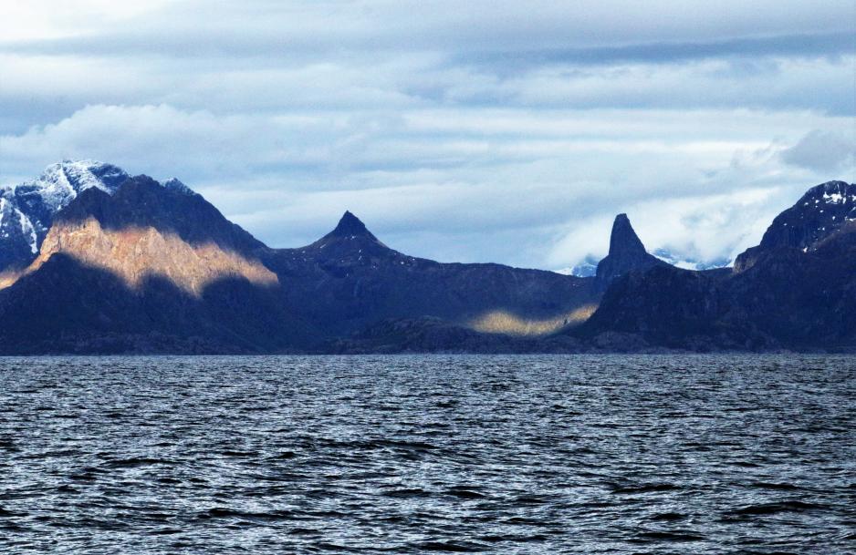
Hamarøyskaftet sits majestically on the other side of Vestfjorden. (Photo: Arne O. Holm)
Heading north, on the ferry that crosses Vestfjorden from Bognes to Lødingen, I found the most precise description thus far. One of the Conservative Party's representatives, Bård Ludvig Thorheim, was one of the lucky ones who were allowed to board the ship in the Oslo Fjord.
In a Facebook post after what is described as a very successful visit, he wishes the crew a good trip to Vesterålen.
Vast seas
However, Vesterålen is not a point on a map in the middle of a narrow fjord. It is an archipelago north of Lofoten of a total of 2500 square kilometers and consists of five municipalities. In addition to an enormous sea area.
The greeting may still have value, though. On the outer side of Vesterålen, flight restrictions were introduced at about the same time.
I had the feeling of being on the right path if nothing else.
Without fanfare and enthusiastic politicians along the line.
Vesterålen not only has seas on the outer side. On the inner side, it shares Vestfjorden with Lofoten, the fjord I was now crossing. Vestfjorden had also been the subject of the speculations around the military voyage.
In that case, it would not be the first time an American aircraft carrier sails this fjord. USS Harry Truman visited in October 2018.
In the middle of the fjord
For those who might think that the "haystack" of Vesterålen is similar to the Oslo Fjord in any way, here are a few facts. The fjord is surrounded by a total of 14 municipalities. Given the curvature of the surface of the Earth, it is difficult to detect a ship much further than ten nautical miles. Even a ship the size of Gerald R. Ford would be difficult to detect in parts of the outer Vestfjord.
In the innermost part of the fjord, roughly where it meets Ofotfjorden, lies Ramsund. Here, the Norwegian Navy's main Northern Norwegian base is located. At its narrowest, Ramsund is similar to Drøbaksundet south of Oslo.
The AIS signals from Gerald R. Ford are still AWOL as I continue northwards. I had to make a choice between the inner or outer side of a geographical area in an already heavily militarized part of the High North.
Quiet for the time being on the Vestfjord.
Along the way, I had been able to map some of the open activity of Coast Guard vessels and military auxiliary ships in this area. Even an Italian military auxiliary ship tasted the salty Northern Norwegian seas for some time.
But there is more
A few days ago, the fighter exercise Arctic Challenge Exercise began. It primarily takes place in the North, across the Nordic borders. The US is also participating in this exercise. Perhaps with USS Gerald R. Ford.
The carrier strike group will will in any case train with the Norwegian Army, Navy, Air Force, and Special Operation Forces in the time coming, according to the Norwegian Armed Forces.
I decided on Vestfjorden instead of the sea areas outside Vesterålen almost at the same time as US MFA Antony Blinken announced that the Americans would open an embassy in Tromsø (Norwegian only). That has been known for a while, but the time of the announcement was hardly accidental.
An ongoing NATO meeting in Oslo also serves as a backdrop. A so-called unofficial meeting of the NATO countries' MFAs. The fact that it is called unofficial means that no decisions are to be made. That will not happen until the NATO countries meet in Vilnius in the middle of July. Then, Finland's, and probably also Sweden's, membership will be decided upon.
There is even more
But more took place on this day.
Denmark presented a gigantic investment in its own defense. For the next ten years, Denmark is to spend DKK 143 billion on defense. The Baltic Sea, as well as the Faroe Islands and Greenland, are at the top of the list of priorities.
And for the sake of balance, even though this commentary is about NATO and the High North: High North News has mapped 19 Russian military exercises in the north in the last month. (Norwegian only)
In other words, if the USS Gerald R. Ford is still sailing north, it sails into a very hectic military exercise area. The cries of encouragement in the Oslo Fjord will be replaced by live-fire shooting.
It is narrow on the roads through the tunnels along the E6.
Black belt
Late Thursday evening, I left the dock in Raftsundet which carves Vesterålen and Lofoten in two. In precisely this area, I had registered military activity in the past couple of days. The captain of the boat, Trond Løkke, has a black belt in sailing the Vestfjord.
He knows the name of every islet and mountain peak as far as the eye can see. A short clearing made a voyage possible. For a few hours, the sea lay quiet almost like a protest against the endless series of low pressures which has sent strong winds and snow across the north in recent weeks.
On the AIS, we see that a minesweeper vessel has left Ramsund Naval Base before the conversation between the two of us is interrupted by a crackling VHF radio.
Then came the message
First in English, then in Norwegian.
"A naval exercise will take place in the Vestfjorden area in the period 2 June 2023 0600 UTC until further notice is given. The exercises require high-speed maneuvering. Vessels in the area are encouraged to keep a distance of 1.5 nautical miles from the naval vessels. Contact the Norwegian Joint Headquarters for more information. End of message."
Perhaps 4500 American soldiers and officers have headed into Vestfjorden anyway. Perhaps they will stay in the sea area on the outer side and content themselves with sending some of the 90 aircraft the ship has capacity for over Northern Norway.
In any case, traffic jams in Lofoten and Vesterålen are unlikely. Nor an armada of pleasure crafts or fishing vessels on the hunt for pictures of the world's largest warship.
Greenland Halibut of the greatest importance
The Greenland Halibut has found its way to the sea areas outside of Vesterålen. After all, that is the most important catch right now.
On Friday morning, the fjord and the coast are still quiet. The temperature is at six degrees Celsius. The weather forecast says rain will come from the northeast.
KV Andenes is heading north in Tjeldsundet, while KNM Olav Tryggvason is bobbing along the entrance to Ramsundet in 2,1 knots.
There are still no signals from the USS Gerald R. Ford.
Also read
This commentary was originally published in Norwegian and has been translated by Birgitte Annie Molid Martinussen.


