Russia considers extended claim to the Arctic seabed

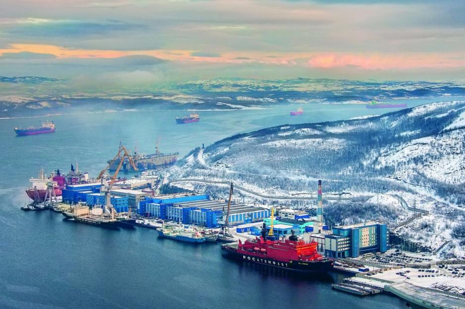
Rosatomflot nuclear icebreaker base in Murmansk. (Source: Courtesy of Rosatomflot)
Two Russian vessels have collected new data in the Arctic Ocean between Canada, Greenland and the North Pole - far from Russia’s existing claim.
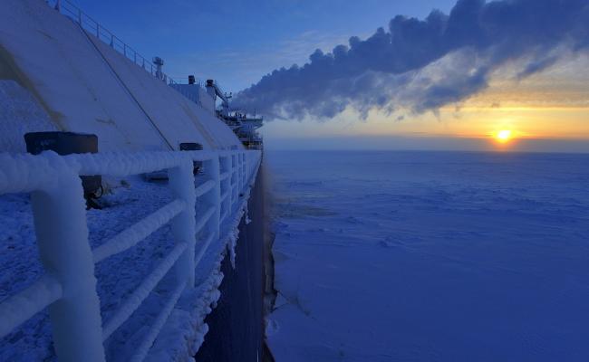
It happened between August and October last year. Through several days, Russia’s large nuclear icebreaker “50 Let Pobedy” (50 Years of Victory) plowed through the polar sea ice between the North Pole and the northernmost reaches of Greenland and Canada. The speed most likely is no more than 3-4 knots.
Despite the climate crisis, the ice in this region can still be several years old, thick as a man is tall and tougher than oak.
The icebreaker systematically clears open tracks in the ice in honor of the vessel trailing it, the “Akademik Fedorov”. The lesser, but ice-enforced vessel methodically sucks up data about the seabed with an advanced multibeam echosounder embedded in its hull.
Onboard the ship Russian technicians, if they do what they have done before, translate the data into colourful computer-visuals of the seabed’s majestic contours.
Focus is on the Lomonosov Ridge, the impressive subsea mountain range that runs from Russia across the North Pole and onwards towards Greenland and Canada. The ridge pushes 3700 meter tall peaks upwards from the seabed which is otherwise flat as a pancake, and the nature of the connection between the ridge and the landmasses at either end will determine who has the rights to what the seabed may hide of oil, gas and minerals.
Consistent rumors about the goal of this ambitious Russian mission can now be verified: The two vessels were harvesting data about the seabed, because Russia is contemplating a revised, enlarged submission to the UN’s Commission on the Limit of the Continental Shelf (CLCS).
A such enlarged submission could win Russia the rights to the seabed from close to the North Pole and down all the way to the maritime borders of Canada and Greenland 200 nautical miles from shore.
Does it belong to Greenland or does it belong to Russia?
According to reliable information an enlarged Russian submission to the CLCS could be underway in a matter of a few months, but we don’t know whether it will ever happen.
Most probably, no-one outside Russia has yet seen the new data; it might be insufficient to support an enlargement, and political barriers on the diplomatic front could also make Russia fold. But the analysis is reportedly in progress;
Russia has received encouraging rumblings from the CLCS on its existing submission, and new details about the latest mission corroborate expectations of an enlargement.
Zig-zag in ice
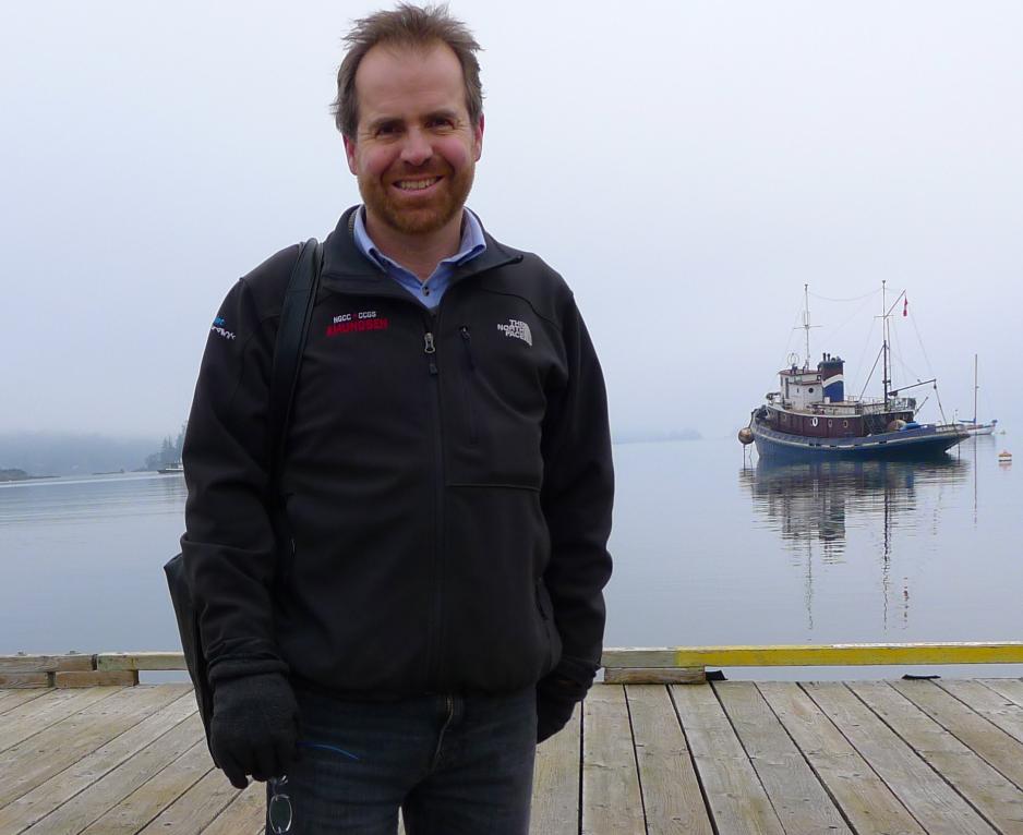
The “50 Let Pobedy” and the “Akademic Fedorov” were operating in the characteristic zig-zag pattern also known from three Danish-Greenlandic icebreaker missions in the same waters between 2007 and 2012 (This reporter travelled on one of them. Journ. rem).
The two Russian vessels toiled forth and back across the Lomonosov Ridge as close as 60 nautical miles from Greenland’s exclusive economic zone. They operated far from the seabed further north that was covered by Russia’s submission to the CLCS in 2015.
The Russian Embassy in Copenhagen has not yet come back on a request for more information about the purpose of the mission, but in November, as “Akademik Fedorov” returned to quay in Saint Petersburg, the Russian Ministry of Defence published a brief news item and a few pictures of the crew.
It was not clear precisely where “Akademik Fedorov” had been, or what the new data was intended for, but we learned that the vessel had returned from a three month mission somewhere along the Lomonosov Ridge and further west over the Chukchi Plateau north of Alaska, where the US has hitherto been alone in its quest for the seabed.
Flemming Larsen, director of the Geological Survey of Denmark and Greenland, GEUS, in Copenhagen, commented on the Russian news item last week:
“It appears that they have done bathymetry, in other words mapping of the topography across the Lomonosov Ridge. Also, they have taken samples of the sediments. It is all about illustrating the character of the ridge: Does it belong to Greenland or does it belong to Russia? But we have not yet heard what came out of it,” he said.
Denmark’s Arctic Command in Nuuk, Greenland’s capital, was aware of the two Russian vessels already when they operated north of Greenland. In December, Denmark’s Defence Intelligence Service foretold in its annual risk-analysis that Russia would “most likely“ enlarge its submission to the CLCS all the way to Greenland’s exclusive economic zone.
Russia might simply have told the other Arctic coastal states about its considerations. Canada, the Danish Kingdom, Norway, Russia and the US have long acknowledged the potential for disruptive disagreements over the still non-existent borders on the seabed and the diplomats and experts meet regularly in order to prevent any slidings towards collision and tension.
Norway has no direct interest involved, but the Norwegian embassy in Copenhagen confirmed that Norway is aware of the Russian mission:
“Norway is aware that Russia has conducted a mission with Akademik Fedorov in the Arctic Ocean, but the mission in 2020 does not cover areas that are part of the Norwegian continental shelf. Therefore, there is no need for prior contact between Norway and Russia about the details of the mission. Generally, the embassy stresses that the activities in the Arctic Ocean are characterized by good communication among the five coastal states. Norway highly appreciates this”.
Closer neighbours
The underlying conflicts of interest are substantial. An enlarged Russian submission could — simply speaking — bring Russia closer to Canada and Greenland than most people would have dreamt off only a few years back.
In the most far reaching scenario, where Russia manages to realize the full potential of an enlarged submission to the CLCS, Russia’s rights to the seabed would begin right outside Canada’s and Greenland’s exclusive economic zones 200 nautical miles from shore.
Security wise this doesn’t mean much.
Russia would have exclusive rights to all resources on the seabed, but, importantly, not in the water column, on the surface, or in the airspace above. Also, Russia would command certain rights to regulate traffic in the area in order to protect its riches.
These are privileges and potential wealth to which Greenland and Canada have so far been the only contenders.
Few security risks
At the heart of the matter are overlapping demands for very large tracts of seabed, tantalizing dreams of oil, gas and other treasure. Whipping up further prospects of drama and strife, however, would run against what most experts expect.
In Denmark, the chairman of the Foreign Policy Committee of parliament, Martin Lidegaard, who was Denmark’s minister of foreign affairs when Denmark and Greenland submitted their submission to the CLCS in 2014, only learned of the Russian mission when approached for this article, but he is not worried:
“If Russia enlages its submission based on new scientific grounds, I can not see that this needs to have any security implications. The Danish Kingdom itself has put forward a large demand, and I assume that we are heading towards difficult negotiations under all circumstances,” he said.
Assistant professor Jon Rahbek-Clemmensen from the Center for Arctic Security Studies at the Royal Danish Defence Academy agreed:
“Security wise this doesn’t mean much. It is international waters, and the Russian’s can sail and fly there as much as they want. The decisive issue for Denmark is whether Russia sticks to current rules and conventions and there is nothing that indicates any breach of the rules at this stage,” he said.
Denmark’s Defence Intelligence Service sees a potential risk, but only if the recommendations of the CLCS rules very squarely against Russia’s wishes. In this case, the service says, Russia might “choose a different approach”.
Canada’s leading expert, professor and Canada Research Chair Michael Byers from the Department of Political Science at University of British Columbia agrees with Lidegaard and Clemmensen:
“I am not alarmed. My assumption is that Russia is simply preparing for all eventualities. In the unlikely situation where the CLCS determines that the Lomonosov Ridge is a natural prolongation of the Asian continent only, Russia wants to have submitted data that enables the Commission to affirm its sovereign rights all the way across to the outer limit of the Canadian and Danish exclusive economic zones”.
Most observers expect tough direct negotiations between the states involved, because the CLCS will find, most likely, that the Lomonosov Ridge connects to both Russia, Greenland and Canada.
In this case, the nations involved will have to negotiate the final borders themselves; the CLCS will not deal with the actual drawing of political borders.
Martin Lidegaard already looks beyond the negotiations.
“An extended Russian submission will make it even more important to talk about how we regulate the area after the borders have been drawn,” he said.
He would like to fully protect a smaller part of the ocean around the North Pole itself and to regulate against pollution and militarization in the rest of the ocean outside national jurisdictions.
Russia “unhappy”
Russia’s submission to the CLCS in 2015 laid claim to the seabed from Russia’s exclusive economic zone to the North Pole and somewhat beyond; it is a possible extension of this claim that is now in focus. A certain amount of anger may be involved.
Denmark’s and Greenland’s submission from 2014 covers close to 900.000 square kilometers of Arctic seabed - it was an unexpectedly massive demand. Following pressure from Greenland, Copenhagen agreed to stretch the demand as much as legally possible all the way to Russia’s exclusive economic zone.
Copenhagen’s Defence Intelligence Service said in its December analysis that Russia was “likely unhappy with the extent of the Kingdom’s claim”.
According to an educated estimate an extended Russian submission could potentially increase the overlap between Russia’s existing claim and that of Denmark and Greenland with some 200.000 square kilometers, adding to an overlap already at 600.000 square kilometers.
On top of this, an enlarged Russian submission would most likely increase Russia’s overlap also with the Canadian and possibly the US designs.
Also read
Time pressure
Interestingly, there is no indication to date that anything of value might be found under the seabed north of Greenland. Also, the ice and the impressive depth of the ocean is likely to deter any exploration or extraction of resources for years to come. That may not be the point, however.
The UN Convention of the Law of Sea has inspired coastals states all over the world to submit claims to the CLCS for large tracts of seabed. The Danish Kingdom, comprising Denmark, the Faroe Islands and Greenland, has laid claim to five:
Three around Greenland, two at the Faroe Islands. It is about resources, but also about the political clout that will follow any such national expansion — in particular, of course, if the North Pole is part of the deal.
Russia may feel that it is under time pressure. The CLCS is reportedly about to finalize its evaluation of Russia’s submission from 2015. If an extension of this claim is to be included in the CLCS’s evaluation this time around, time may be an issue.
Russia’s keen interest in the Arctic seabed has long been evident. In 2007, two small Russian submarines dived 4300 meter to the bottom of the ocean at the North Pole and planted a Russian flag. While president Vladimir Putin praised the Russian divers, many governments were worried:
Would Russian naval vessels follow up and make claims to the Arctic seabed by force? Would Russia disregard international law in the Arctic Ocean?
Russia’s foreign secretary Sergey Lavrov called for calm: The US flag on the moon did not lead to any US claims of ownership either, he said, and Russia has adhered scrupulously to the rules of the UN Convention of the Law of the Sea ever since.
Russia is likely to win large tracts of seabed simply by following procedure; it would have next to nothing to gain from any breaches.
Also, Russia may want to test any potential extension of its existing claim in Copenhagen, Ottawa and in the rest of the Arctic coastal states before submitting it to the CLCS. The commission is only mandated to evaluate a claim if all involved agree to the process.
Norway, Denmark and Canada are unlikely to protest as long as Russia adheres to the rules and existing agreement, including the so-called Ilulissat Declaration from 2008. Washington, however, may be less easy to predict.
The US has not signed the UN Convention of the Law of the Sea but it has expressed clear intentions to win its proper share of the rights to the Arctic seabed.


