Record low ice extent, warm temperatures further threaten ice
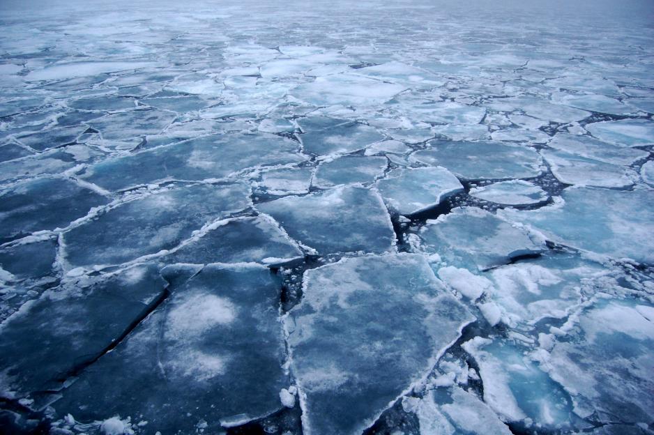
Drift ice in the Arctic Ocean. (Photo: Wikimedia)
Arctic sea ice continues to set new record lows. In January ice extent in the Arctic Ocean averaged 13.38 million square kilometers, the lowest since satellite observations began in 1979, and 260,000 square kilometers below the previous record set just last January, reports the National Snow and Ice Data Center in the United States (NSIDC).
Arctic sea ice continues to set new record lows. In January ice extent in the Arctic Ocean averaged 13.38 million square kilometers, the lowest since satellite observations began in 1979, and 260,000 square kilometers below the previous record set just last January, reports the National Snow and Ice Data Center in the United States (NSIDC).
The low extent in January also represents the fourth consecutive month in which ice coverage either set a new record low or, in the case of December, closely matched a previous low. This is something that has not happened in the past 38 years.
"We are certainly sailing into uncharted territory," said Prof. James Overland, research oceanographer at the National Oceanic and Atmospheric Administration.
A new month, a new record low
In October 2016 extent stood at 6.4 million square kilometers which was 400,000 square kilometers below the previous record. The discrepancy became even greater in November when coverage was 800,000 square kilometers, more than twice the size of Norway, below the previous low figure and averaged 9.08 million square kilometers. In December extent nearly matched the low recorded in 2010 at 12.1 million square kilometers.
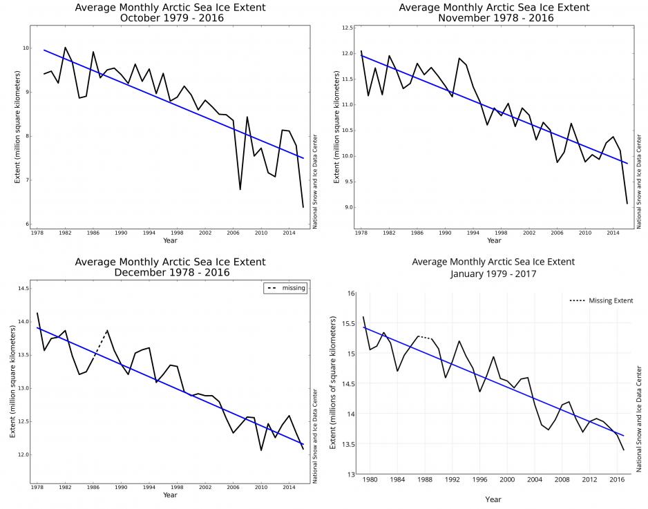
Decline of average ice extent in October, November, December and January.
(Source: Courtesy of NSIDC)
While it is unclear why exactly winter ice remained so low in 2015-2016 and this year, one factor was the delayed freeze up during Fall, which kept ocean temperatures above normal. This represents an Arctic-specific feedback process which amplifies, or enhances the rate of change, explained Prof. Overland.
In January ice coverage was missing especially around the Svalbard Archipelago, where the inflow of temperate waters from the Atlantic prevented the formation of ice, as well as in the Barents and the Kara Seas. On the North American side of the Arctic ice extent was also well below average in the Bering Sea, according to the NSIDC.
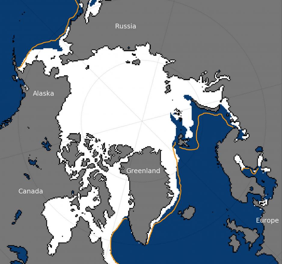
Average ice extent in January 2017. Yellow line denotes historical average 1981-2010.
(Source: Courtesy of NSIDC)
Storm pushes mild air into Arctic
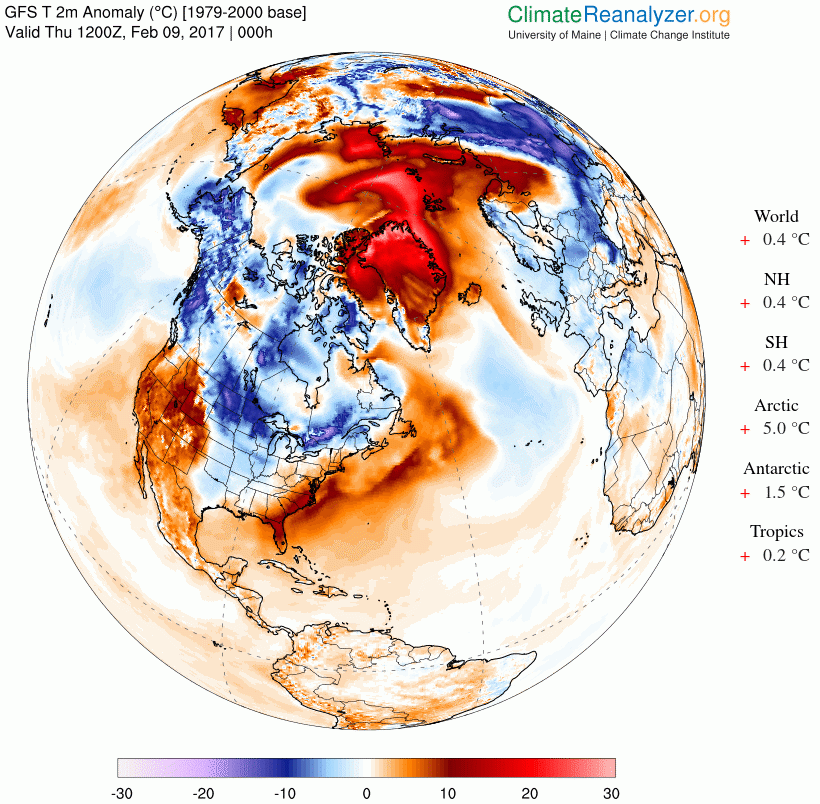
While much of the Arctic Ocean has seen above normal temperatures for large parts of the winter, even more abnormally mild air worked its way in from lower latitudes in North America during the past week. A strong North Atlantic storm with hurricane force winds sunctioned warm air into the Arctic raising temperatures as much as 30 degrees Celsius above normal for this time of the year. Longyearbyen on Svalbard saw several days with temperatures well above freezing.
The inflow of warm air will further delay the buildup of thick winter ice which usually grows rapidly during the months of January and February before peaking in March. A similar event with warm air penetrating deep into the Arctic also occurred last winter in December 2015.
Warming events are becoming more frequent
In a study published by the American journal Nature in December 2016 Prof. G.W.K. Moore, Climatologist at the University of Toronto, looked at these warming events and their increasing occurrence.
According to Prof. Moore, warming events historically occurred once or twice per decade with the earliest recorded event in 1959. Over the past two years, however, the Arctic Ocean has witnessed four of them, with three of them coming in the past 13 months.
The inflow of warm air relies on "the presence of a deep extra-tropical cyclone in the vicinity of the pole that transport warm and moist air towards the pole" as well as a "highly perturbed polar vortex that brought the jet stream close to the pole," states Moore.
However, despite their significant impact on the loss of winter ice in Arctic Ocean “remarkably little is known about these midwinter warming events [...] including their frequency, duration and magnitude as well as the environmental conditions responsible for their occurrence.”
"After last winter I thought that the great extremes has a large random component, but how does one interpret two extreme years in a row", Prof. Overland concluded. "It is still not clear why winter ice stays low into the winter, unless the whole system has shifted."